AORAKI – MT. COOK, February 25-28

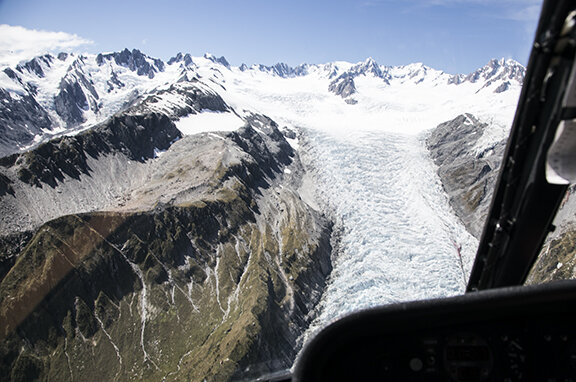
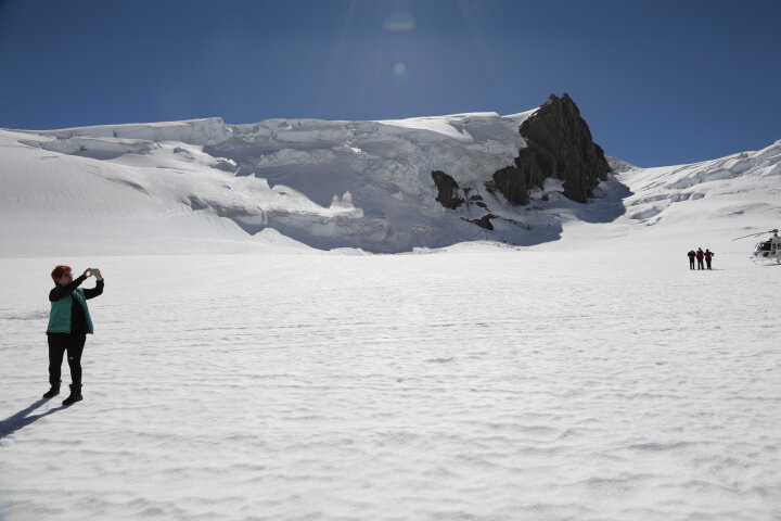
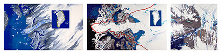
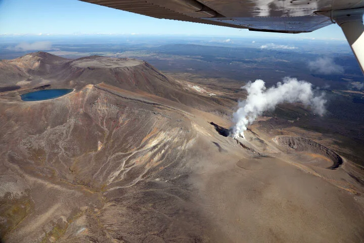
“Aoraki” means “Cloud in the Sky” and was the most spiritual place we went to in all of NZ. It was held as one of the most sacred sites of the Aboriginal people.  Having seen it from the air two days earlier, and landed on its snow bank, we knew we had to stay in Aoraki/Cook National park – home to the biggest and best of New Zealand's glaciers - two thirds of southern Alps ice are found here.

c0fa4b3f9a4aa977-1_cook.jpg

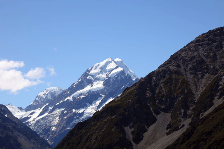
The mountains surrounding us were breathtaking.  Here is a description of this 12,349 feet high mountain from Haast in 1862: "The magnificent pyramid of Mount Cook… stood high above all, towering into the sky. As far as the eye could reach, everywhere snow and ice and rock appeared around us and in such gigantic proportions that I sometimes thought I was dreaming, and instead of being in New Zealand I found myself in the Arctic or Antarctic Mountain regions."

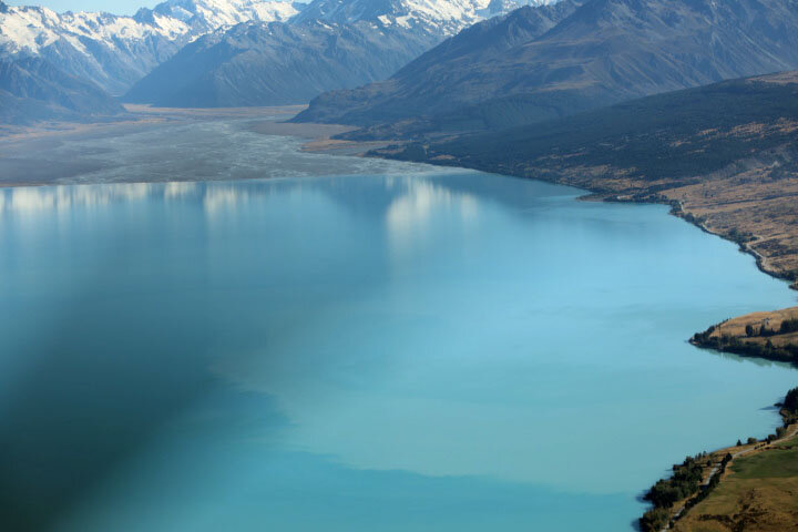
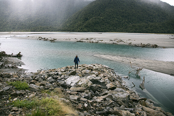
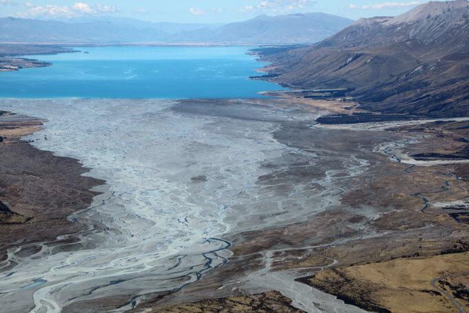
Aside from gazing up, we also focused on the Tasman River which is the alpine braided river we had previously photographed from the air lying between he Tasman Lake and Lake Pukaki in the distance.  

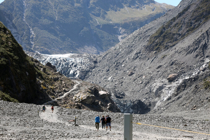
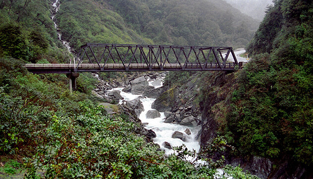
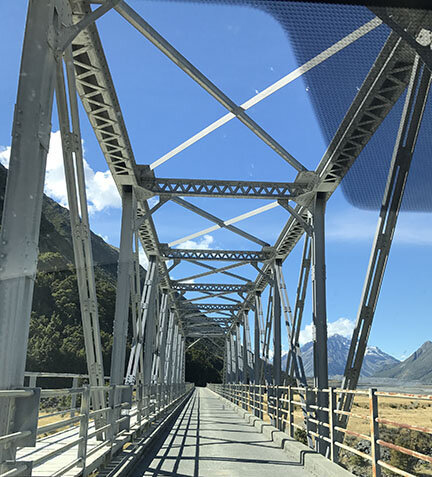
We flew over the same bridge across the Hooker river get which was the result of outflow from the Hooker and Mueller glaciers (right next to Cook) that we then drove across for our first trek.

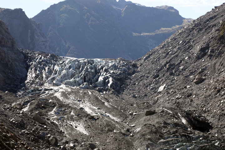
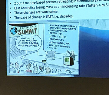
The first climb brought us to a high vantage point,

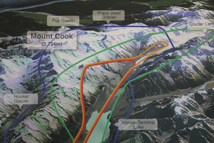
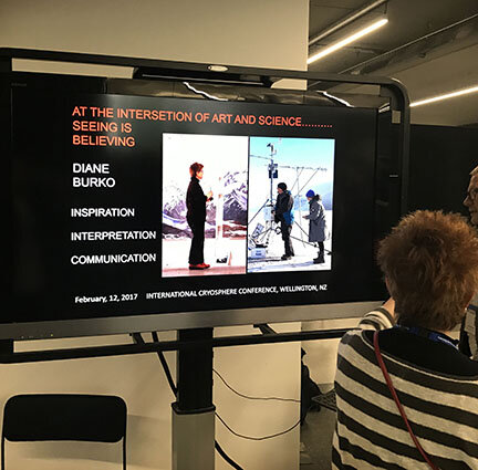
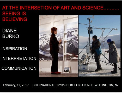
which had a wonderful display educating the public about climate change:

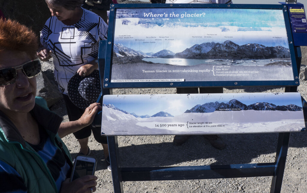
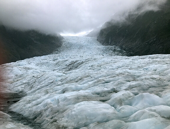
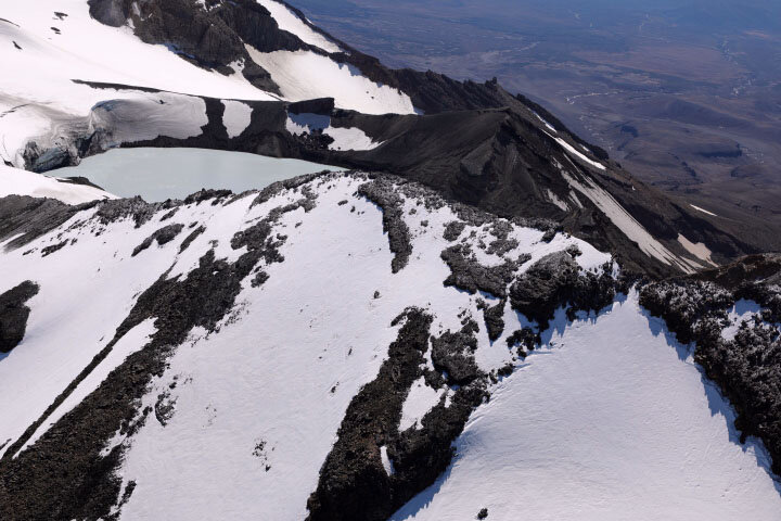
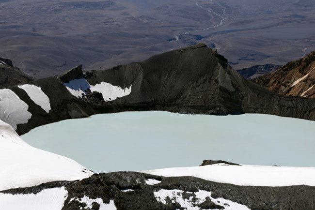
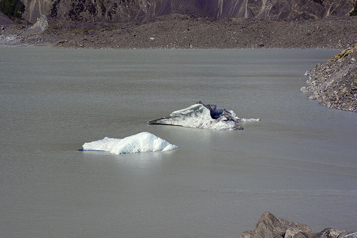
We walked to three different viewpoints to see the Tasman runoff that we had first spied from the air.

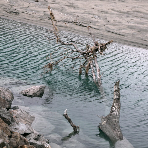
The water’s chalky white gray green color was magical to observe with a few floating icebergs scattered throughout.

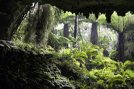
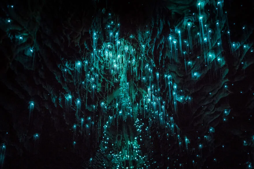
It was our last connection with the natural world before heading to Christchurch and fro there Austraila by way of Tasmania to see MONA in Hobart..

APPROACHING THE GLACIERS FROM THE EAST

The next day we flew from Queenstown to the Mt. Cook airport where we boarded a pontoon plane and flew back up towards Mt. Cook where we landed - but also had the opportunity to view Fox and Franz Josef Glacier again from the East.

On the Way from Queenstown we learned about how their glacial lakes contributed to the electrical power grid throughout the area.

From the south we climbed up toward the glacial range and Mt. Cook.

We landed at Cook airport and switched to a sea plane.

4153bf4ddf376c26-4_flite.JPG

which would fly us onto Cook and over the range for many photo opportunities before we landed on the snowfield of Cook.

QUEENSTOWN AND MILFORD SOUND

We drove to Queenstown to set up base for both a flight over and trip on the Milford Sound. Milford Sound is a geological wonder I had been hearing about for years.

aa5d4b461c74ec05-1_MAP.png

As the world’s continents began to shuffle around each other to form the unmistakable outlines we see on maps today, tectonic activity was stirring in the Milford Sound area. As two plates began to rub together, the rocks beneath splintered and shifted, protruding through the waters to form the mountains that tower over New Zealand’s Fiordlands.

During the most recent ice age, 18,000 years ago - the volcanic sediment that came to characterize Milford Sound gave way to sharp glaciers. Ice firmly embedded itself from the mountaintops down to the valleys, and although it would later melt, the stamp it left on Milford Sound formed much of its mysterious character.Floating down towards the Tasman sea we could see how the hills on either side became more rounded as we approached the terminal end of the former glacier. 

Captain Cook passed the entrance to Milford and so it remained unexplored until 1812.

The text day we took two flight: from Queenstown to Cook Airprt- then over thre glactial ramge and then to Cook-  on the reurn  our first pilot flew us back from cook over Milford and so we approached flying up the sound seeing it form the air.

e03c9139c87fe2c3-4_aboveMS_.jpg

ON THE ROAD FROM GLACIERS TO QUEENSTOWN, February 21

On the way to Queestown after we stopped at Haast Pass there was so much more  to see that  we continued to pull over more.    

It seemed during this five hour plus drive we were compelled to stop often to photograph the glistening deep turquoise blue waters of Lake Wanaka.  Because of glacial run off -  the waters were sometime so clear - I may do a whole series just about that:

and sometimes milky white with sediment as we had seen earlier near the Fox Glacier and would again in the future when we got to Cook and Tasman.

87eb643a018f0745-4-6U4A0424.jpg

But I’m getting ahead of this narrative now.  Our drive from Fox to Queenstown was way over five hours because we also stopped to see the “Blue lakes” and the “Salmon Café” where there was a fish farm…

FOX GLACIER - TWO VIEWS from the WEST: 2/18-19

I’ve added a new task to my public outreach list: interject additional climate change information into the tour guides’ narrative…As we trek up dry river beds where meters of ice lay a mere 10 years ago, or stand on top of glaciers looking out onto horizons – I add some facts - in a casual way…

The guides seem eager to pick up on it and the tourists become more engaged. Guides have told us that many (especially those they meet from China) have never seen glaciers before and seem clueless about their increased melting….

 On one walk Paige pointed out a notch high up along the cliff edge telling us that was where ice steps began so people could descend onto the glacier…

ca2ce04c5c68b90b-2_NOTCH.jpg

It was at least 20 stories above us -  now a rock face lined with shrubs - thirty years ago all ice.  That's when begin I begin to add more facts...

Like the fact that a third of the permanent snow and ice on the Southern Alps has vanished in less than four decades. And that scientists have measured that the Alps' ice volume has shrunk by 34 per cent - and those ice losses have been accelerating rapidly in the past 15 years.  The walk up to the face has extended dramatically each year and now tourists are no longer allowed to climb up from the face, because the surrounding hill slopes are much less stable.

The increased calving and glacial retreat is impacting the sediment in the glacial valley. Its been reported to have risen by more than a meter (over 39inches) in just the last two years.

The only way to get on top is to fly over and be dropped off by helicopter.  Which is what we did the next day after walking the dry river bed, we landed about three quarters up unfortunately in weather much less friendly:  cold windy and raining…

It was an arduous trek with a bit of slipping but well worth the effort.

5b0883b8f410c16f-5_FOXSHOT.jpg

FRANZ JOSEF GLACIER and SECOND VIEW OF FOX: FEBRUARY 19

After more than two-hour trek though ice and snow we decided to take a user friendly explore of Franz Josef the next day.  We opted for more flight time and less on the ground exploration.

The Franz Josef Glacier is right next to Fox - about 17 miles South. It was named after Emperor Franz Joseph of Austria by the German explorer, Julius von Haast in 1865. On our way from Karamea to Fox we traveled over the Haast Pass:

Flying was a great decision because we could view from the air both Fox from yesterday plus Franz Joseph which is right next to it as well as the Tasman range. This flight gave a us a deeper sense of the Southern Alpine range approaching from the West.

Landing was easy and there we were two thirds up on Franz Josef walking in nice soft snow not ice...

96b1ba1a25304fae-3_ontop.JPG

SCIENCE IN SOCIETY AT CAFÉ SCIENTIFIQUE…

I was scheduled to speak on the same evening as Eric Rignot. They made sure to arrange the timing so that we could all hear him first. My presentation was sponsored by “Science in Society”  - a group formed by Victoria University Faculty members who are committed to bringing science education out to the community. So, I was scheduled to speak at the “Hideaway Bar"- A first for me...

There were about 50 people of all ages attending and we had a very lively discussion after my talk - what a way to spend Valentine’s day…

SOUTH ISLAND: from PITCON to NELSON TO KARAMEA – FEBRAUTY 15-16-17

On the 15th we took a ferry to across Cook Strait to Picton whi took about three hours and we were lucky to have very smooth sailing which is not always the case we learned.

From there we drove to Nelson, stayed overnight visiting the Suter Museum the next morning - which also had a great café for breakfast.

Then we took a long winding drive all the way west to reach the Tasman sea and then climb northward to a small town called Karamea and the “Last Resort Motel” which was just about at the end of the road.

Our goal was to visit the Honeycomb Hill Caves early the next morning in Kahurangi National Park. Luckily we had a very experienced guide, Yvonne, who drove us on a perilous road - known as one of the most dangerous in NZ. We climbed up around 500 feet above sea level and then down into the Opara basin. We were then led on a trek through magnificent tropical bush and across chain bridges which eventually brought the six of us descending deeply into a cave where we then climbed up and down beneath the ground we had previously traversed….  

We could see the actual roots of the trees we had just seen earlier from above. It was a magical world of limestone stalactites and stalagmites and more Moa bones.

After about two hours of creeping climbing and exploring, we saw daylight again:

WELLINGTON: DISCUSSING CLIMATE CHANGE….

Driving about four hours from volcanic country through winding hills reminding us of the Amalfi coast, we arrived in the very windy city of Wellington on Sunday, 2/12 in time for me to participate in the opening events of The International Cryosphere Conference.  The conference gathered scientists from all over the world (much like the AGU but way smaller) where papers would be presented throughout the whole week.  Its director, James Renwick, having been alerted of my coincidentally being in town, invited me to contribute. Seeing everyone enjoying themselves at this “icebreaker” we both agreed that a lecture hall was inappropriate – so we spontaneously changed the venue to right there:

My 15-minute talk began by thanking everyone for their research and assuring them that we are all with them. Then I shared images of collaborations with many of their colleagues along with examples of work and my outreach efforts. I closed with the image of my upcoming book for the Walton show:

b29651131b660361-2_cover.png

I suggested they sign up so they could receive news from my distributor when its published in March. The editor of a UK journal suggested getting an advance copy to them for a possible book review.  More drinking and interesting conversations continued withpeople from the UK, China, Tasmania, Hawaii and from the states.

Richard noticed that Dr. Eric Rignot was from his alma mater – Irvine.  We had a delightful conversation with him that first evening – not knowing then that he was the keynote the next day.

His topic was: “Have we Passed the Point of No Return?” Short answer: YUP

He very calmly explained the data of the most current models and how crucial paleo research shared across glacial science disciplines over last decade have added to the certainly of those models and inevitability of further sea level rise without strong changes in global behavior. He reviewed the data in terms of key “floodgates” in Greenland and Antarctica which they are all monitoring…I was thrilled to see that two of the three he showed from Greenland: Jakobshavn and Petermann have been glaciers I have referenced in my imagery:

We spoke afterwards, and after reading up on him I mentioned that we had met Charles Elachi, former director of JPL in Banff at the Renaissance meeting – he then informed me that was who hired him...small world.

Here was the last slide of his talk:

EXPLORING TONGARIRO FEBRUARY 10 -11

We awoke early in Rotorua to get to Tongariro National Park, our next destination. This volcanic wonderland is among New Zealand’s most striking landscapes and is its first national park established in 1887.  In it are three mighty volcanoes Tongariro, Ngauruhoe, and Ruapehu all dominating the horizon big, readily accessible, and all still active.

We were hoping to meet our pilot for a noon flight, but as the drive provided incredible vistas at every turn, the clouds grew ominous by the time we got to Chateau Tongariro at 11AM.

We postponed hoping for better weather the next morning and went exploring instead. We took a hike to a water all and witnessed a typical kiwi just dive in…

0d50ef65e92d20fc-3_jump.jpg

A clear sky greeted us the next morning for our flight with Bhrent Guy, the senior pilot and director for Mountain Air (Your Volcanic and Heritage Scenic Flight Adventure). We not only circled the main volcanoes in the area at a range of heights and angles, as well as flying back up to Lake Taupo - we also learned a great deal about their geological history.

I was paeticulary taken with Mount Rehapehu, always omnipresent in the landscape as we drove there and away the next day towards Wellington...

ROTORUA AND BEYOND: EXPLORING GEOTHERMAL LANDSCAPES…

Rotorua is a land of geothermal pools, lakes, and steaming geysers located in the heart of the North Island’s Taupo Volcanic Zone. All due to its last major eruption - about 240,000 years ago. 

49ddfdf701b838d3-1_VOLCANICZONE.jpg

Richard and I spent two days living at the edge of the Lake Rotorua, on “Bay of Plenty” a thinly water covered Caldara.

f0dbb7cb3cdca246-2_outside.jpg

The first day, we walked almost 10 miles today capturing the most incredible images of bubbling gurgling mud and sulphur vapors - right in the middle of town…

The next day we drove about a half hour from there to Wai-O-Tapu Geothermal Area with similarities to Yellowstone National Park – It was wonderful to explore the hot springs and pits of bubbling mud.

cbc81ccecb729ded-4_secondday.jpg

From there we drove to Waimangu Volcanic Valley where we explored a “new” thermal eco-system created by the eruption of Mount Tarawera in 1886. This litho was made by A. D. Willis, based on a painting by Charles Blomfield. The view is from the Māori village of Waitangi, on the northern shores of Lake Tarawera:

d3d1cf0e3104ec4d-5_1886.png

That hike was gruesome- but we survived….

THE WAITOMO CAVES

Wai means water and tomo means hole in Maori.  The caves we explored on Wednesday were formed thousands of years ago by water pouring through the limestone layers – the former seabed of this area - now its surface. We visited this town, Waitomo of only 40 residents which receives over a half million tourists each year- including us…. After putting on our helmets,

8b9ea0a6f47fd318-IMG_4612.JPG

about a dozen of us (from many parts of the globe) followed our guide deep into a cold a damp cave. Why? To see the glow worms which populate the ceilings and walls of these dark wet caverns, to learn about bioluminescence and to learn that these creatures are not really worms after all, but maggots…

It was truly a magical, surreal experience and satisfying our curiosity and need to understand our geological history.

Deep inside one of them we came upon the skeletal remains of a Moa...

74ccd2db9eef4e3b-moaremains.jpg

 When the Polynesians settled New Zealand around CE 1280, the Moa population was about 58,000. Think of “big bird” and you get the idea of these creatures who sometimes reached about 12 feet in height with their neck outstretched, and weighed about 500 lbs.…

a8033871ae9354db-MOA.jpg

They were the dominant herbivores in New Zealand's forest, shrubland and subalpine ecosystems for thousands of years - until the arrival of the Māori who hunted them down. Their extinction occurred around 1300 primarily due to overhunting by Māori- similar to what happened in the states to the mastodon and wooly mammoth.


AOTEAROA = NEW ZEALAND

On the morning of February 2, we arrived in “Aotearoa” - this name was originally used in reference to the North Island of New Zealand but now is the most widely known and accepted Māori name for the entire country. The word Māori refers to the indigenous people of New Zealand. Both the term and the people are a hybrid of various Polynesian cultures.

5235d7cf5604659f-AOTEAROA.jpg

Auckland, (the original capital of both islands because of the Maori) with its impressive museums, provides the perfect introduction to the history and attitudes of this country …

 The Auckland Art Gallery, aside from presenting some important contemporary artists such as Lee Mingwei (http://www.aucklandartgallery.com/whats-on/exhibition/lee-mingwei-and-his-relations-the-art-of-participation)

 and Ann Shelton (http://www.aucklandartgallery.com/whats-on/exhibition/ann-shelton-dark-matter)

immediately gave us insight into a rich and complicated cultural history through an exhibition of more than 120 historical portraits of Māori and Pākehā by their most prolific professional colonial painter, Gottfried Lindauer (1839-1926).  

Then, by visiting the War Memorial Museum, we learned of the rich Maori heritage of these people who first settled here a thousand years ago. Through informative exhibits and videos the deep political tensions between the European settlers and the original peoples was explained.   We learned about the 1840 Treaty of Waitangi treaty and the many protests movements culminating in 1975 which set up a tribunal to redress colonial injustices.  Since, there were many settlements including some land returns, compensation and an apology from the crown.  A 1995 settlement included a formal apology from Queen Elizabeth II. I found their ongoing reconciliation and negotiation efforts in stark contrast to ours in the United States.

And ironically tomorrow, February 6th is Waitangi Day (named after where the Treaty of Waitangi was first signed) – a national holiday commemorating this deeply significant day in New Zealand's history. 

GETTING READY TO DEPART...

In just three days I begin an adventure to a part of the planet I have never explored. We leave on the 31st of January and due to the international dateline, we won’t arrive in Auckland, New Zealand until February 2.

Aside from the complicated demands of packing camera gear, computers and clothing for trekking on glaciers, volcanic terrain and in rain forests, there are the multiple power points I’ve been working on. The first will occur in Wellington where I’ve been asked to participate in the welcoming events for the International Cryosphere Conference:

and, later in the week, the Science in Society Group (Victoria University) has asked me to speak to their Cafe Scientifique public program:

Some thoughts, before flying to Auckland on January 31...

Back in the 80’s, I got a postcard from Sarah McCoubrey who on her honeymoon wrote: “Burko this country is made for you - it has every possible landscape you can imagine.”

Ever since, I’ve dreamed of traveling to New Zealand. And now that it’s finally a reality  - Australia, Tasmania and Hawaii have been added to this upcoming adventure. 

639520ea714795a9-MAP_NZ.jpg

The term Down Under is a colloquialism which refers to New Zealand and Australia -  both countries being below the equator. Already in 2012-13, and 2015, I got to almost 60 latitude below, when Richard and I sailed to the Antarctic Peninsula. This will be the next big adventure since my Polar Investigations project.

This adventure will provide the chance to revisit content I explored in the early 2000’s: volcanoes  (1999-2004) by spending time in Rotorura on North Island.  

and my still on going project on global wrming by visiting the fast melting glaciers on the South Island.

Climate change remains my passion. By broadening my reach for landscape experiences, I will bear witness to the shrinking Franz Josef and Fox glaciers in South Island, as well as dried up river beds in Australia. I also will be continuing my pubic engagement speaking to a range of audiences about how my practice addresses global warming and my personal journey.