UPSALA GLACEIR - NEXT FROM ABOVE on JANUARY 10, 2015

Seeing this glacier from above was the last challenge of my expedition  witnessing  indications of climate change.  To get to our overlook destination we first landed on the Park shoreline known as Christina Ranch which was originally settled by the British MacMaster family in the  early 1900's to breed sheep.   All the passengers were then packed into crude 4x4 vehicles parked along  80 year old Lake William.

We formed a convoy of about 4 vehicles each loaded with 12 individuals.  Slowly we  wound,  lurched and crept up a steep, bumpy  dirt road.  Luckily there were subway like poles above to hang onto.

We were climbing up a granite mountainside which had been covered twenty thousand years before with glacial ice.   And 500 million years  before that,  it was a flat sea bed - still part of Gondwana -  before it tectonically was pushed into the mountain ranges and valleys of ice today.

Evidence of this geological phenomena were all around us under our feet in...fossils were embedded everywhere. 

In 15 minutes we all walked from the vehicles to the edge of the cliff. 

The harsh powerful winds of Patagonia finally greeted us with ferocity as we scrambled up the embankments, trying to get a secure  footing to take photographs.

39eb00a4bb5fa558-15_UPSALA_2copy.jpg


We then turned back down, loaded into our trucks and headed to lunch at the Christina Ranch on William Lake...


WELCOME TO MY 2015 ANTARTICA AND PATAGONIAN ENTRIES....

It is Saturday January 17th and I have finally completed my entires about my most recent investigation.... There are 13 separate ones describing my expeditions to Antarctica and the Patagonian Ice Field of Argentina. I suggest scrolling down to the beginning in order to get a chronological sense of the journey from December 27, 2014 to January 11, 2015.

Please visit my sites: www.dianeburkophotography.com and www.dianeburko.com  In the months to come. I hope you will see how this incredible experience influences my practice at the intersection of art and science where I communicate issues of Climate Change. With every investigation I make – the reality of our predicament intensifies. The threat is real – I am witnessing it and hope my art can contribute to positive change.

VIEDMA GLACIER ON JANUARY 8

On January 7th we disembarked from our ship, said  goodbyes to our SOI family and quickly got to the airport to fly to El Calafate - our destination for the next part of our adventure. We arrived exhausted at a lovely hotel: Los Sauces. The next morning we rose early for a quick breakfast- collected our box lunch and traveled north some 110 miles to El Chalten - a hub for mountain climbers and adventure seekers situated close to the Andes Range. The mountain Chalten is named "smoking mountain" because it's usually enveloped in the clouds.

Our destination was Viedma:  a large valley glacier whose moraine rich terminus flows into the Western end of Lake Viedma which is formed primarily by its melting ice.  Twenty minutes after leaving Chalten we arrived at the pier for our ferry ride  to this glacier.

Traveling up the glacial lake we saw the front the glacier as we approached many icebergs.

We remained there for over an hour taking photos.

After getting breathtaking views of the front from the right side we continued to be captivated by a huge collection of  icebergs all around us.

We headed out of that area toward the left end of the glacier, docking along a steep granite embankment where we gathered in groups to climb up the granite boulders towards and onto the glacier.

8bbcb6f1ed1c07b6-climbingalongedge.jpg

It was steep and challenging  on the huge boulders to get to the ice ahead, including climbing a ladder 
from one height to another.

We all put on crampons - heavy metal ones quite different from the plastic ones I had stretched over my hiking boots on Kronebreen 2 years and 4 months ago.

Then began a two hour magical wondrous journey up and over ridges with many steep climbs and descents between crevasses.  

b436ef26b8e45d2a-pathahead.jpg

Our guides would occasionally  use their ice picks to make some steps for us for the really steep area, but mainly they just taught us how to utilize the crampons in these more challenging situations.

I diligently followed each and every step of my kind guide Pablo - sometimes gladly taking his hand as he patiently coaxed me along narrow paths of ice winding and wending our way  across terrain I cannot believe I was traversing....

 I only stopped to photograph when i had his permission. This was not one of those easy shoot and walk kind of a missions...This was definitely the most challenging trek I have ever done!

For almost two hours we embraced views of speckled ice interspersed with deep shades of rich blues of the crevasses surrounding us on all sides.The images I captured were so magical, astounding and so different from my Arctic Circle experience in Svalbard. Clearly, each glacier has it’s own particular personality.

(All our arrangements in Patagonia were made with a great Chilean agency, Santiago Adventures: http://www.santiagoadventures.com).


PERITO MORENO GLACIER - Janauary 9

When first planning our Patagonian expedition I thought of only visiting the fabled Perito Moreno Glacier with its three mile front named after the explorer Francisco Moreno.

He was a pioneer who studied the region in the 19th century and played a major role in defending the territory of Argentina in the conflict surrounding the international border dispute with Chile.

I planned to photograph it as I traversed on foot and also from the air.  However, neither of those goals came to pass....I learned upon landing in El Calafate that sadly, the sole pilot had perished with his helicopter three weeks earlier, and there were strict rules preventing anyone over 65 (no matter how fit) from being allowed to climb...

Ironically, an even more thrilling climbing experience happened  for me the day before on the amazing  Viedma glacier. It seems that Perito Moreno, where over 500 tourists trek daily in high season - was way easier.  So instead of climbing and flying,  we first drove to the National Park's elaborate viewing platforms to see the huge front.

It's 20 mile deep body extended slowly  back into the ice field, vanishing into the clouds.

There were a few calvings as well contributing to an incredible collection of ice along its edge.

The melange of ice was moving as we watched from various levels along the walk down. We were standing on Magellan's Peninsula where to the right was the north end of the glacier, while to the left we could see the spit of land which in the past had been joined to the glacier thus dividing the body of water in two. This phenomenon happens periodically . When the pressure produced by the height of the dammed water breaks through the ice barrier   - it causes a  spectacular rupture sending a massive outpouring of water from the Brazo Rico section to the main body of Lake Argentina.  This dam–ice-bridge–rupture cycle recurs naturally  and happened last on January 19th 2013.  We saw a great film about it in the Glaciarium  Museum in Calafate.

After spending about 45 minutes there we got back in our car to take a boat to the southern face  getting  closer to the front. We were now on the other side of the land mass we had just been on.

2d5943c1238d9032-otherside.jpg

Here was an opportunity  to see  the front at almost eye level.

35bfefc473db089a-southside.jpg

And  what a colossal site it was...

f6c9fc312bb171fe-upfront.jpg

UPSULA GLACIER - (first by water) on JANUARY 10

We left the hotel by 7:30 in the morning to catch an 8:30  boat heading north on Lake Argentino into the northern channel towards the Upsala Glacier. It, like Viedma and Perito Moreno flows from the Southern Patagonian Ice Field. Upsala used to be the largest glacier of the three we visited  but has lost enough in the last ten years to cede that position to Viedma.  It is known for its rapid retreat. This repeat image shows this history:

a4285b0a5f3cd8f6-then-and-now-chooyu.jpg

However, while this glacier is melting,  Perito Moreno has remained stable.The glaciers i visited don't all demonstrate consistent evidence of global warming. Climate science emphatically agrees that we are at a tipping point - but its complicated -  more research is needed in this part of the world.

We traveled up the lake,  passing though a narrow opening to the North Channel to view its icebergs and get close to the front. The only access this glacier is by boat....

We were on the water for over two hours slowly approaching the front of the glacier passing many incredible iceberg formations.


Through all my polar expeditions, wherever there are glaciers,  I am greeted with a complexity,  and variety of forms combining into magnificent compositions.


There are always different unique and magical images to capture.


After that ride we landed on shore to pile into crude 4x4 vehicles to mount a long  bumpy trail up to a look out on William Lake which just formed about 80 years ago.

THE THIRD LARGEST ICE SHEET: PATAGONIA

Having already experienced Antarctica - the largest ice field in the world, and then this past summer the second largest, Greenland, I was eager to visit the third largest: the Southern Patagonian ice field (which is shared by Chile and Argentina) on this 2015 adventure. While my BLOG is titled “Polar Investigations” the actual location the at the 53rd latitude is not – but the glaciers visited certainly qualify experientially.

 Perito Moreno glacier - whose front is 3 miles long, was my initial destination. We also added Upsala Glacier to our itinerary, located on the northern channel of the same Lake Argentino (the largest in Argentina). 

However, because of a tragic helicopter accident in late December, we had to cancel a day of flying and instead booked an all day excursion to Viedma Glacier. This change in plans was fortuitous for two reasons: 1) I was unaware of this amazing glacier and 2) I was allowed to climb on it – unlike Perito Moreno where I was restricted on account of my ”advanced” age… Ironically Viedma was by far the more risky and amazing climb. I was told it also hosted fewer people with more attentive guides….

All three glaciers are located in Los Glaciares National park in Argentina. The park's name refers to the giant ice cap in the Andes range shared by both Chile and Argentina. There are actually more glaciers on the Chilean side but every Argentinian guide assured us they had the best ones…


(All our arrangements in Patagonia were made with a great Chilean agency, Santiago Adventures: http://www.santiagoadventures.com).

LEAVING ANTARCTICA: JANUARY 4 TO 6

As we headed back in our zodiacs towards the ship after that last landing, a humpback whale greeted us. We reamined watching it perform for us for some time.

Antarctica , often described as the ‘Last Continent’, is far from bleak and bare as I hope my images have shown -  but it is also thriving with life adapted to its extremities.  Aside from the huge Krill population, there were penguins, seabirds such as pintadoes, storm petrols, terns and wandering Albatross -  as well as many whales to see.  Throughout the voyage we gather on deck tom behold their majesty...

I remained on deck for my last impressions of Antarctica as we headed north through Dalman Bay past the Melchior islands.

By 6 PM we were out in open waters heading towards the Drake Passage once again. This was a different route from our start on December 28th where our goal was to include Elephant island. Here’s a map that might help:

JANUARY 4: NEKO - OUR LAST LANDING IN ANTARCTICA

Landing on Neko alongside Paradise Bay was such sweet poetry for me. First discovered in the early 20th century by the Belgian explorer Adrien de Gerlache,  it was named after a Scottish whaling boat the Neko, which operated in the area between 1911 and 1924. This other worldly destination  was one of the highlights of my last voyage.

7abe0831bdee9273-neko.jpg

I understand it to be the most visited tourist destination on the continent - no wonder  - since it has it all: sparkling views of enormous icebergs seen after climbing up high above, a rocky coast line of rocks scattered with ice, and a glacier providing thunderous noise of the icebergs crashing against one another as they intermittently calve.

Two years ago i climbed to a vintage point and looked down below. This time I decided to stay along the shore and focus more on the icebergs and the glacier. 

As I walked along the shore and looked back i spied a camera set up high facing the glacier. As assumed, I later found out from our SOI Director, Geoff Green, that was indeed James Balog's (of Chasing Ice fame) time-lapse camera.

4d2e7af60c88a542-nekoglacier.jpg

THE LEMAIRE CHANNEL TOWARDS PLENEAU - MORNING January 3

We began our morning heading into the Lemaire Channel, which brought back many visual memories. I recalled those monumental black and white mountains from two years ago. I think it was even better this time - perhaps because I was more prepared to seek out what I had found before. There seemed to be more mist traveling through and over the peaks with sharp contrasts of coal blacks.

0faed01dce0d4ae8-Lemaire_a.jpg

Also revisited the melange of ice and and the most exquisite turquoise icebergs below me.

Also present was a playful Minke whale who seemed to escort us all the way.

There was great deal of ice and thankfully we had a skillful Captain who successfully maneuvered us through the narrow passage

We then embarked on  zodiac rides around the surrounding icebergs. Again I was shooting non stop trying to capture the incredible play of color, light, texture, scale and magnitude all around us

cbeefde34d009df5-working_Y7A6940.jpg

There are so many images too present. More will have to wait for my website...

PLENEAU AND THE PILLOW ICE CAPS OF THE WAUWERMAN ISLANDS

January 3rd was an intense day.   From 11:00 until around 1:00 pm we visited Pleneau Island, which was our most southern landing at 65 degrees 07 South. While the attraction was some Weddell and Leopard seals, I focused more on the view and the melting ice all around me…

Throughout the expedition I found these formations which I plan to build into a large grid piece:

585e78fc04009848-Pleneau_melt.jpg
1d2154ac46a1638b-melt_1_Plen.jpg

 After lunch we headed back through the channel toward the Wauwerman Islands at 64 degrees 55 South.

c8f666ff504e99e3-Wsmaller.jpg

They are a group of small, low, snow-covered islands - small ice caps forming the northernmost group in the Wilhelm Archipelago, first discovered by a German expedition in 1873-74.

We headed to one of the only laudable ones: "Koerner" ice cap. Students on Ice first went there a few years earlier at the suggestion of the glaciologist Fritz Koerner. SOI hopes to get that particular island to be formally named in his honor.

This 70 m tall ice mass has been a Students On Ice research site since 2009. When we all got to the top one  of the goals for the students  was to retrieve a temperature sensor and data logger drilled int the ice two years ago.   The "hobo" box which was found and replaced with a new one.  The stake was measured to determine  whether the ice cap shrunk or grew since the last visit in 2012.   New ablation poles wee placed and ice cores were taken . There was also time for snow angels, snow balls and ice hut building....

FROM DECEPTION TO BAILY HEAD TO DANCO: 1/1-1/2

We traveled south all night from Baily Head which we visited on the afternoon of January first It's located on the east side of the outer edge of Deception Island and has at least 500,000 Chinstrap penguins on it.

We arrived early the next morning at Danco Island and took zodiacs there by 9:30  - spending two hours taking in magnificent vistas. As I climbed up the trial I continued to turn back photographing the water  and surrounding mountains.   Out in the distance through those clouds peaked the continent.

The group hiked up a steep snow trail to an outlook where they could clearly identify it.

I attempted following but after many sinking steps in deep snow most of the way up I decided to forsake the last part of the trek and happily slid back down the steep incline.  I carefully continued down to the rocky shore - avoiding the paths of the Gentoo penguins and continued shooting along the shoreline.

The ride back to the ship was special as we circled a number of distinguished icebergs.

After lunch the ship was heading through the Gerlache Strait into the Neumayer channel with dramatic mountains greeting its passage on both sides.

STUDENTS ON ICE EXPEDITION BEGAN....

It is January 11th - the day of my departure from Patagonia. The last two weeks have been a whirlwind of visual and social experiences. I will first endeavor to capture some of the highlights of the Students on Ice Expedition to the Antarctic Peninsula. We sailed on Janaury 28 through the Beagle Channel and onto the Drake Passage which was rather easy.

December 31 started with zodiac rides round Elephant Island's Point Wilde where Shackleton left his 22 men on April 24, 1916 to seek rescue when their ship, the Endurance,  was crushed and sunk by pack ice on October 26, 1914, after a 2 year adventure fraught with struggle disaster and fortitude. His is a tale for everyone to know and admire.

In the afternoon we made our first actual landing on the continent a with a visit to Argentina's Esparanza research station.

On the last day of 2014 - I stepped foot on the continent of Antarctica - for the second time in my life. What a joyful privilege!.  Only about 40,000 people visit this remote southern region, the bottom of our planet - less than the number going to a single baseball game.

However my polar investigations adventure truly starts the next day - the first day of the new year with our landing on DECEPTION ISLAND. I was there just years ago photographing the abandoned whale oil tanks. Having the chance to return to revisit and capture these forms in the landscape again under different light with more snow was such a gift.

And this time I found also decaying huts and structures left behind from the BAS, Argentine and Chilean stations all abandoned in 1970 after a major eruption on this still active volcanic island.

9362c3146c61fc1e-hut.jpg

FROM WINTER TO SUMMER IN TEN HOURS….

We left Philadelphia yesterday with temperatures in the 40’s and now we are in Buenos Aires where it is in the 80’s….Staying in the Recoleta area of the city known for its great historical, cultural and architectural interest - and also for the Recoleta Cemetery where Eva Peron and every other famous person is buried.  It is also one of the most affluent neighborhoods.

Being here for the Christmas holidays is strange… yet peaceful – a time for quiet reflection and some r&r as we prepare for the upcoming intense adventure with the Students on Ice Expedition. We are studying the list of 66 students and 23 fellow educator members. We fly to Ushuaia and board the 278 foot long M/V USHUAIA the day after tomorrow.

BACK TO ANTARCTICA IN 2014-2015

This interview originally appeared on the Students on Ice Blog

Every year SOI attracts curious students and world-class educators from around the world to help bring the Polar Regions to life during transformational expeditions. More recently, we’ve begun to highlight these incredible teachers on our blog. With the Antarctic 2014 expedition website live, and the countdown until the expedition on, we’ve launched the first in a series of Q&As to highlight the incredible educators who make these expeditions possible.

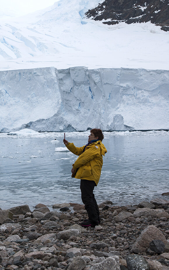
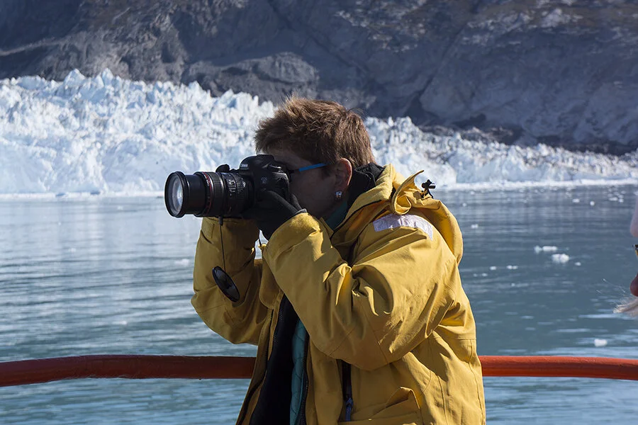
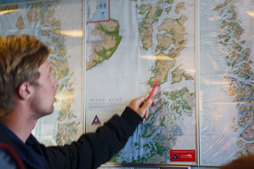
Diane Burko is an award winning landscape painter, and more recently she’s gained recognition for her photography. Although she’s been to both Poles on previous expeditions, this will be her first Students on Ice expedition.

How did you first learn about Students on Ice?

I learned about SOI from the photographer David Freese who was part of the Educational Team in 2013 to the Arctic. A mutual photographer friend put us together – and coincidentally he was scheduled to be part of an artist residency to Svalbard in the Arctic Circle which I had already done the year before. David suggested that I would be a valuable addition to SOI.

What sparked your interest in the Polar Regions?

As a landscape painter and photographer it was the logical next step when in 2006 I began to seriously study Climate Change sparked by Gore’s Film, Inconvenient Truth and Elizabeth Kolbert’s Notes on a Catastrophe. My practice relocated to the intersection of Art and Science. And in some sense I see myself now as both a landscape activist and artist.

To you, what makes Antarctica special?

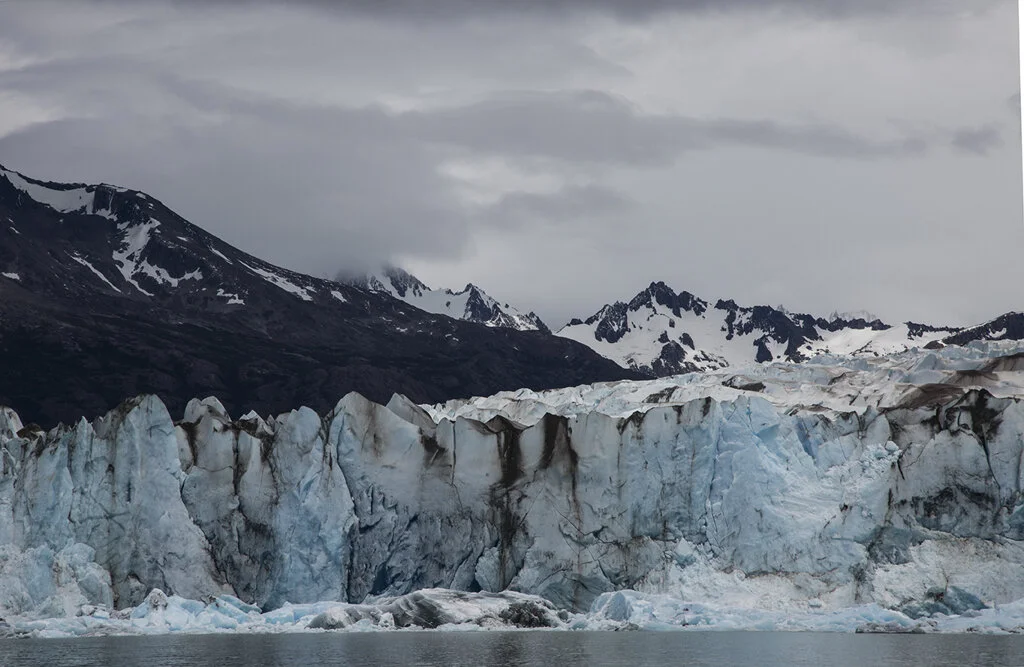
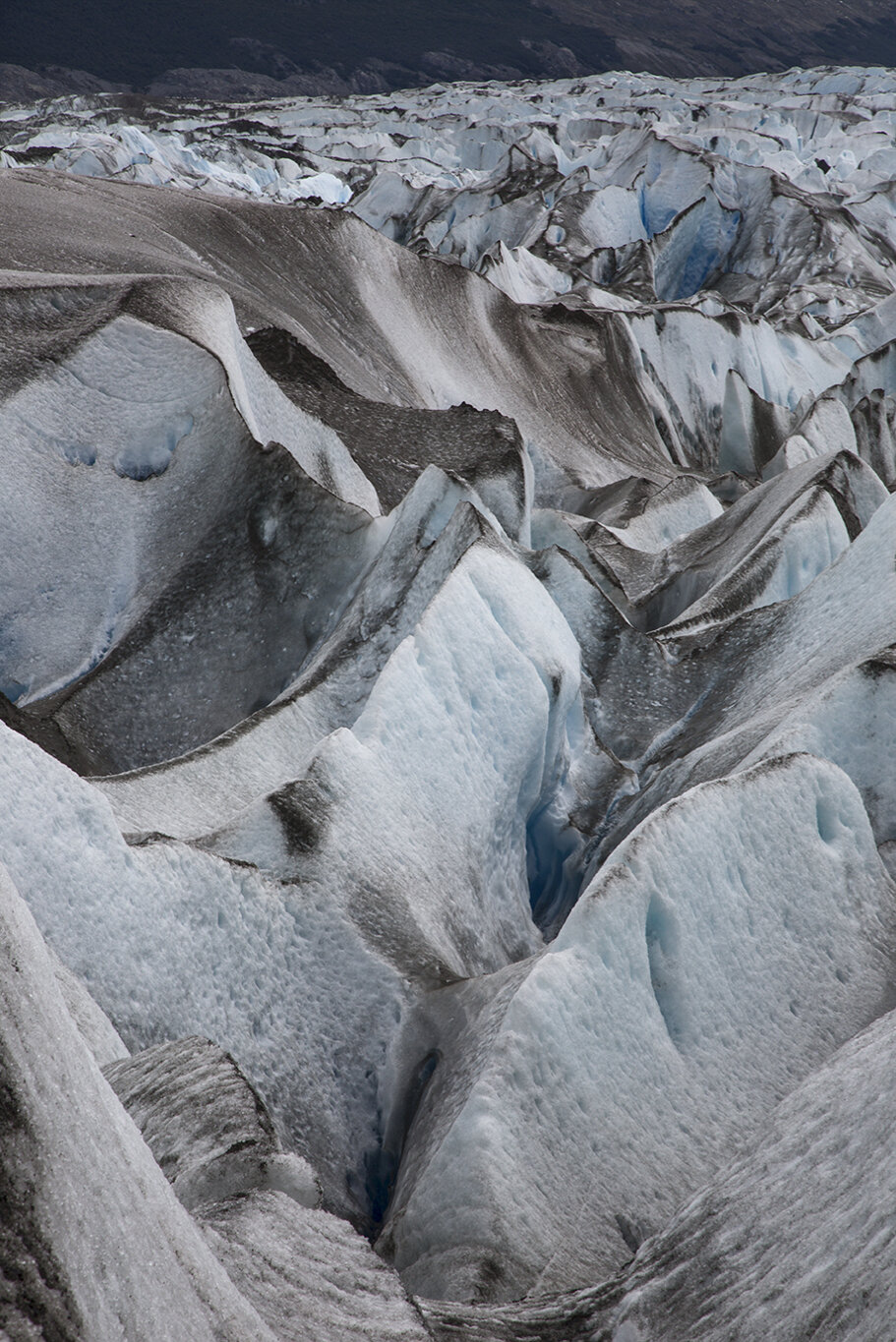
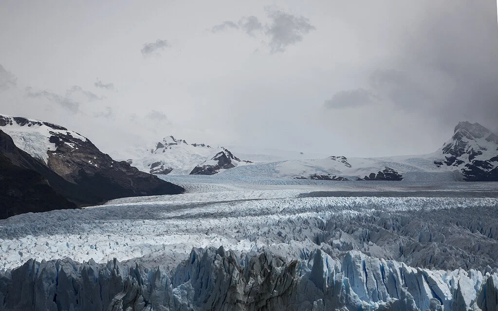
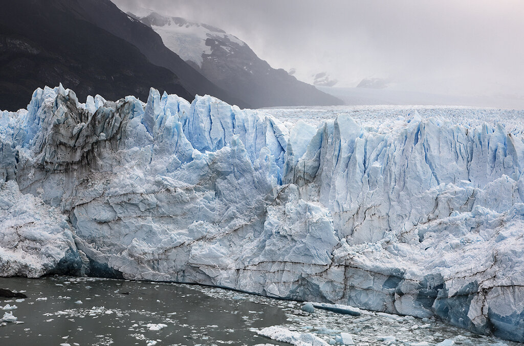
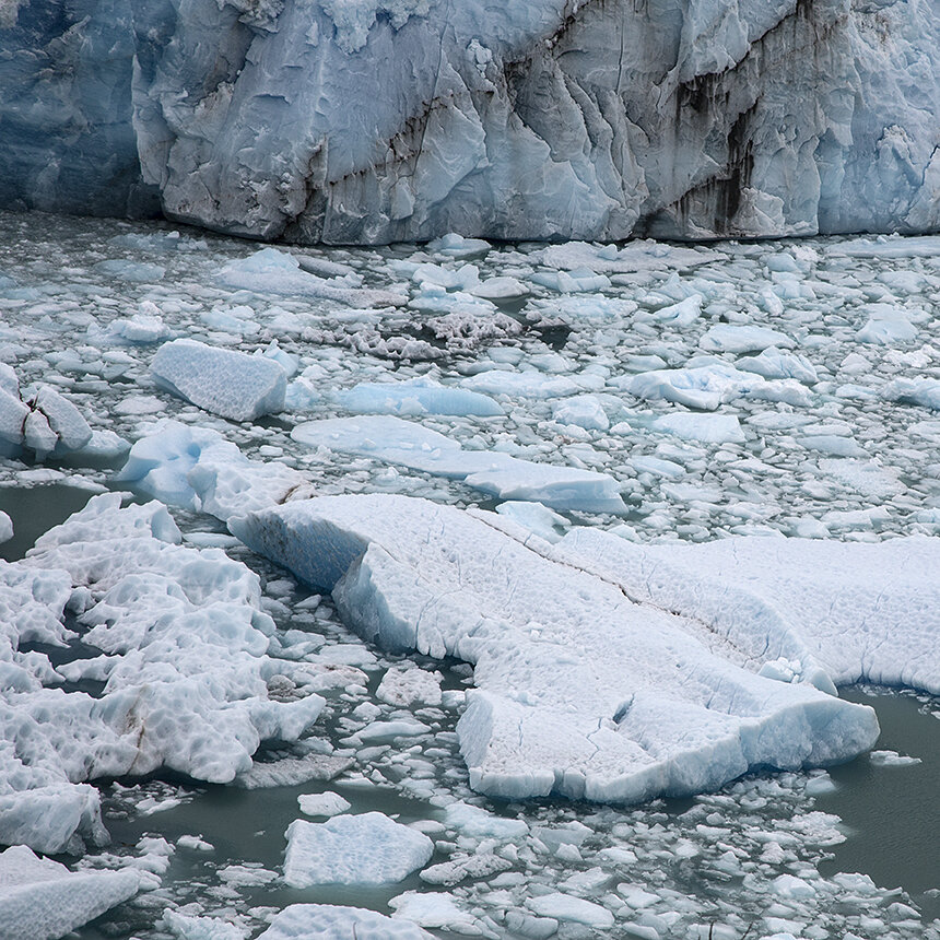
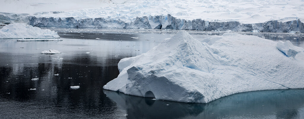
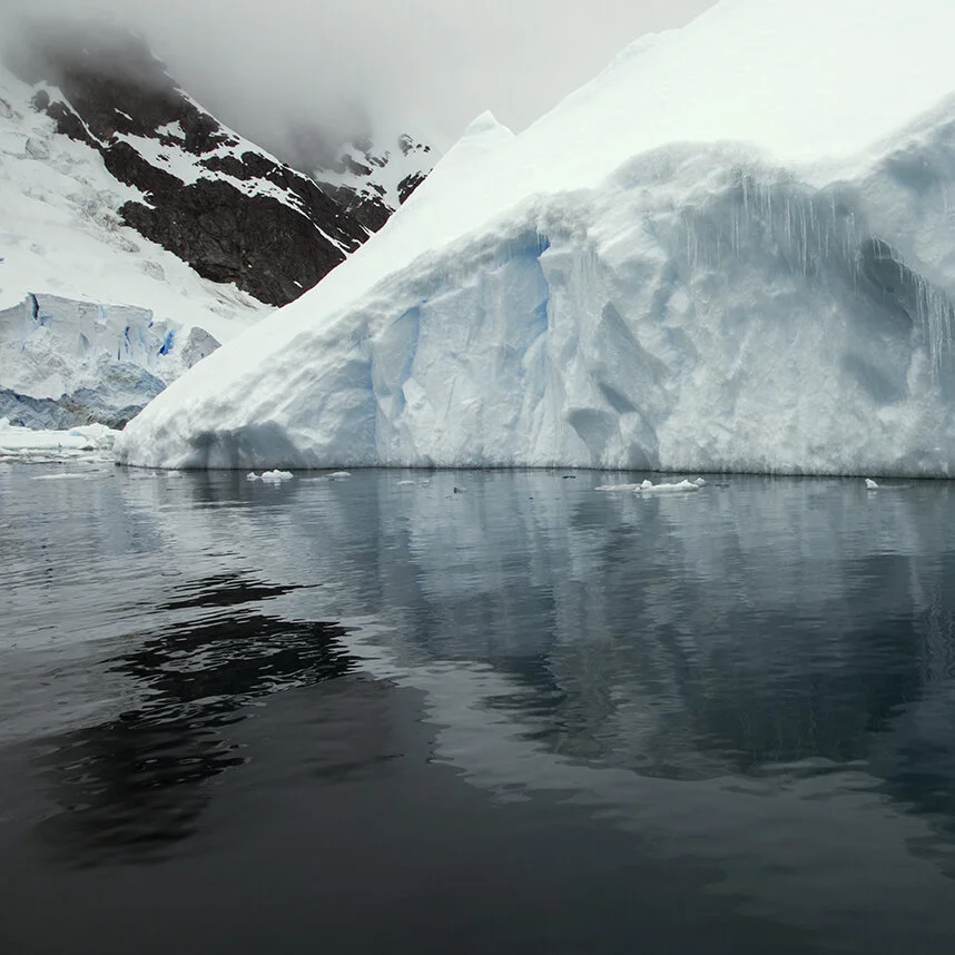
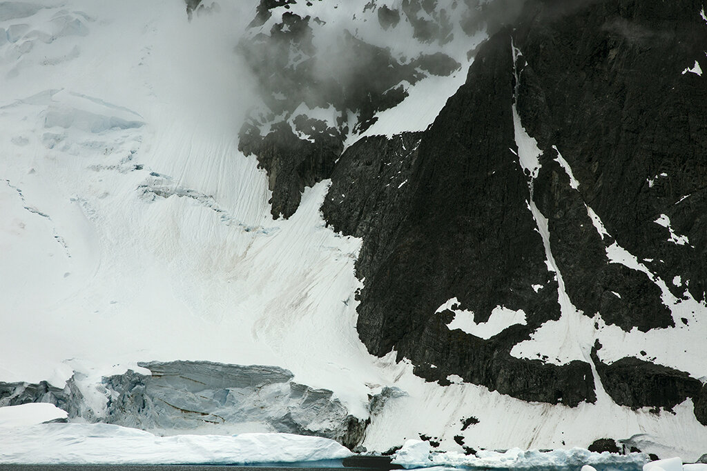
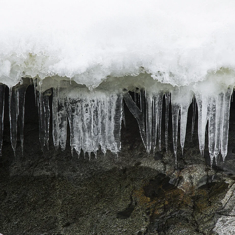
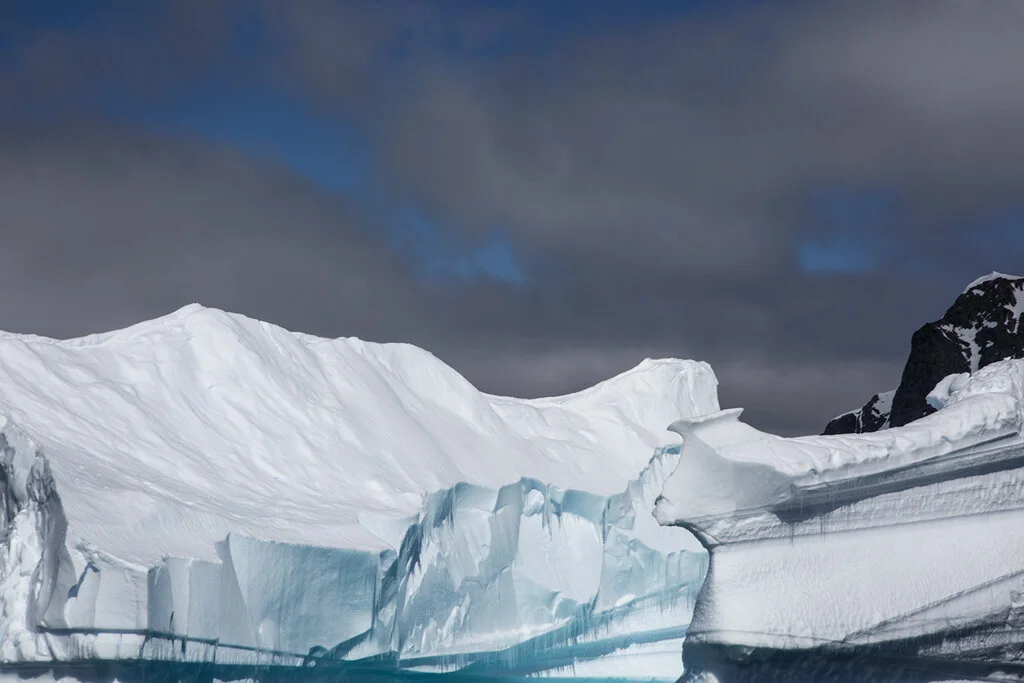
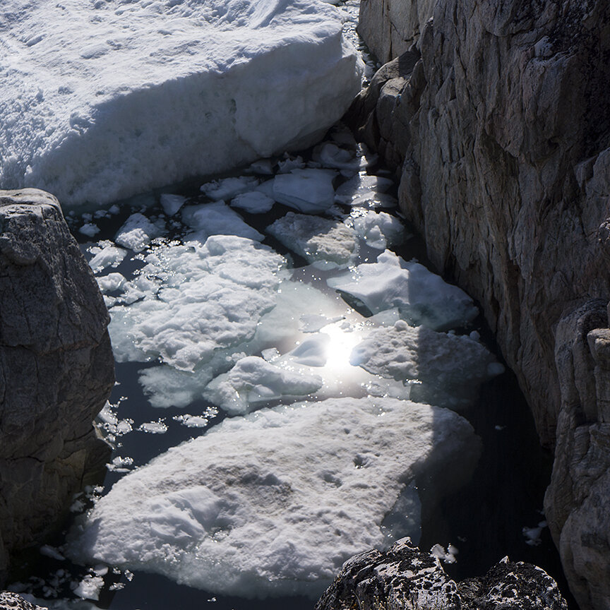
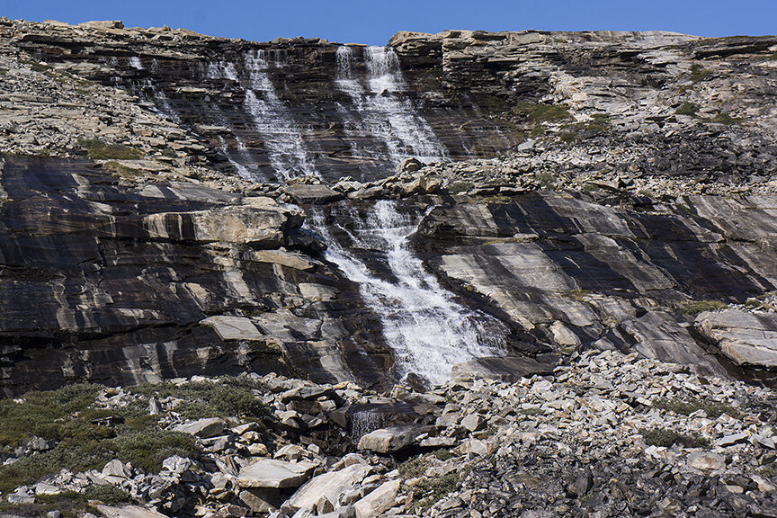
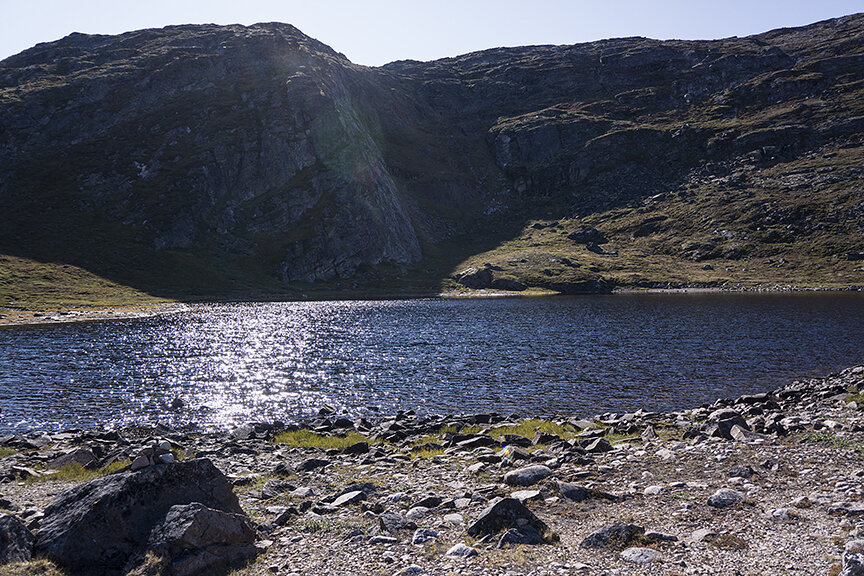
There is an otherworldly majesty to this remote end of the world that can only be experienced by being there. The shades or grey, blue, black and white are infinite in depth and surprise. The light is spectacular. There is a monumentality that commands awe, reverence and a sense of urgency…

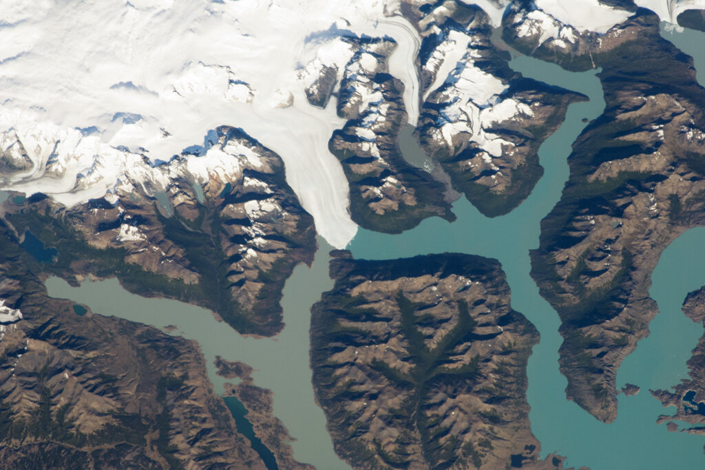
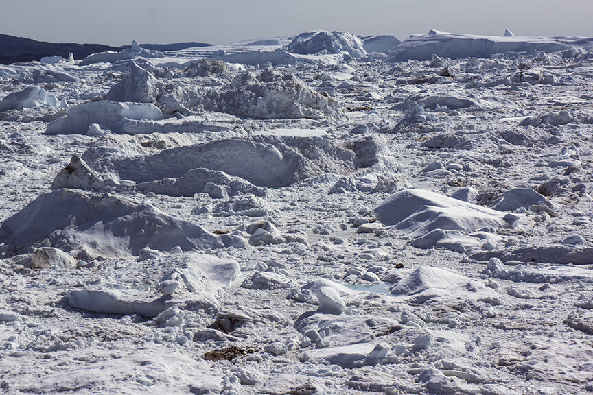
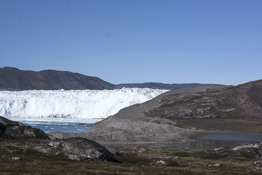
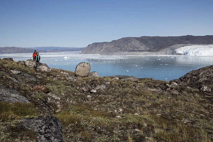
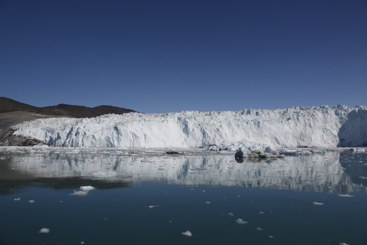
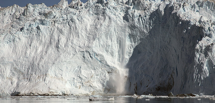
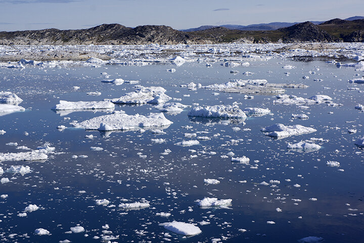
I am eager to return to this magical place being aware of new scientific research on the melting of the outlet Thwaites Glacier that is connected to the West Antarctic Ice Sheet. It’s the size of Florida and up to 4,000 meters thick and considered a key question mark in making projections of global sea level rise. I think over 90% of all the ice in the world is in Antarctica – meaning that over 90% of all the fresh water on earth is there.

Do you have any memories of your previous trip that stick with you?

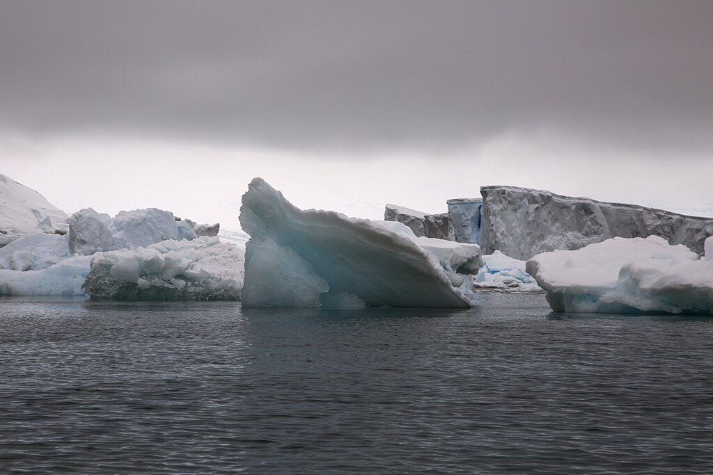
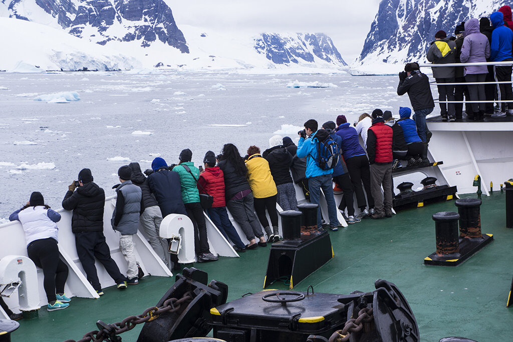
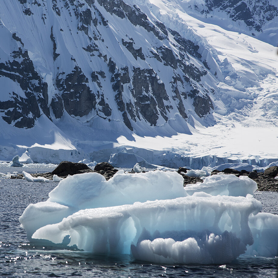
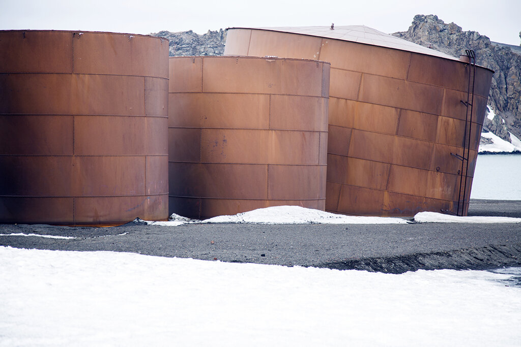
Landing on Elephant Island at Point Pointe Wild where Shackleton had left his men stands out in my mind in terms of the history of exploration. Visually I remember vividly shooting monumental icebergs from a Zodiac one late afternoon with the light exquisitely performing for me…. as well as climbing up onto the continent and shooting back to the sea.

Tell me a bit about your background as an artist?

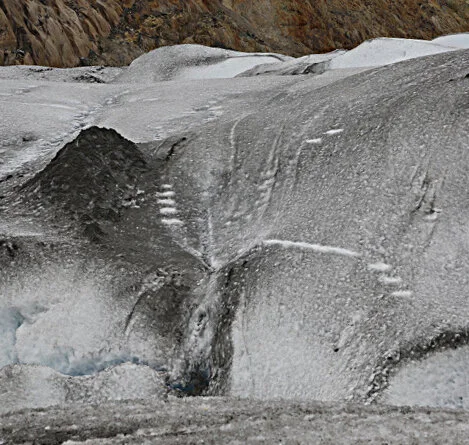
As mentioned my subject throughout my long career has been the landscape. I have always been “science curious”- I love to understand how and why things happen – particularly when it comes to the earth. I’ve realized in retrospect that most of the monumental environments I’ve sought throughout my career are dramatically impacted by some geological phenomena – like the Grand Canyon, Volcanoes and now glaciers.

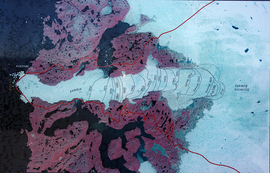
However, The stark difference with my current Polar Investigations project is that glaciers like those in Glacier National are not naturally receding like they have for thousands of years. Now that accelerated melt has reduced the 150 glaciers counted in 1850 to barely 25!

What excites you the most about the Students on Ice education program?

I think it is an absolutely priceless opportunity for this generation to become the leadership to

hopefully steward out planet back to health.

What do you hope share with the students?

Having been a college professor for almost 30 years, I enjoy the give and take exchange with students. I continue to learn from them and hopefully some of my knowledge and insights can be helpful as they experience Antarctica. I think I can provide an aesthetic point of view an alternative way of interpreting what they are experiencing through visual imagery. I also hope to share some of the knowledge I’ve gained over the years collaborating with glaciologists.

Do you think it’s important for scientists and artists to work together? And what are some of the ways this can come about?

I know scientists definitely appreciate an artistic interpretation of their data. They value our ability to communicate to the general public through compelling images. I’ve participated on numerous panels at the AGU (American Geological Union) as well as the GSA) Geological; Society of America) to discuss how Art can Communicate Science. Just recently I was at CU Boulder meeting with a large group of of researchers.

Do you have any advice for budding artists?

Follow your passion- only make at if you cant stop yourself- it’s not an easy profession.  Have a day job.

Follow the 2014 Antarctic Expedition!

ONE MORE OBSERVATION, ABOUT ROOMS WITH VIEWS…

It is Friday, August 15th and I am waiting in the airport to board a plane back home. So many images, and so many ideas for work swimming in my head, and so many visceral experiences on the ground hiking and from the air over all that ice. Much to process in the weeks and months to come.

All that exhausting activity (both emotionally and physically) was left behind as we spent the last four days enjoying the sophisticated city of Copenhagen. Instead of exploring granite and ice it was museums, neighborhoods and some fine restaurants.

I realize there is one more aspect I should mention about this expedition to Greenland. Aside from the outdoor experience of the glaciers by walking, sailing and flying - there was an added bonus: all the views from our rooms…and decks.

First at the Ice fjord Hotel we could watch the icebergs and track how fast they moved and grew in just a few days from sunshine to our last day of rain.

b3a0f9fc832ef528-window-rain.jpg

Our cabin at the Eqi: Lodge provided a ringside seat for a performance by Eqi Sermia

Yes indeed, much to process...

BACK TO OBSERVING ILULISSAT FJORD, FRIDAY AUGUST 8

The extent of time and the number of vantage points that one can have is what makes observing the huge "melange" of all the crumbling ice in the fjord such a unique experience.

Climbing up over the granite cliffs to the mouth of the fjord and then flying over it was the perfect introduction on Monday and Tuesday. On Friday, the day after we returned from Eqi we took another route further in - part of the "blue" route.

We had seen this trail from our earlier trek. Now much higher up, we spied the boulders where I took a break while Richard walked down by the coast. This new route also allowed us to get closer up along the edge. We could watch how the ice and pools of water pushed against the granite walls. Another incredible opportunity for images and sore feet...

This expansive accumulation of ice is not that unusual for a glacier - the process is to accumulate snow during the winter and then shed ice by calving in the summer.

All of Greenland's glaciers drain from the central ice sheet which covers more than 80% of this island. But this particular glacier's production is extremely prolific - and frightening....

Here are some facts gleaned from an online NASA Observatory (6/11/14) article on Jakobshavn (the Danish name for Ilulissat):

Since 2000, Greenland has lost some 739 gigatons of ice, and approximately 30 percent of that loss came from Jakobshavn and four other glaciers. That loss, along with surface melting, has caused Greenland’s ice sheet to start losing more ice than it gains...

“A good indicator of what a calving event means at a particular glacier is the longer-term position of the calving front,” says NASA Goddard glaciologist Kelly Brunt. This year’s calving event continues a trend that goes back more than a century. Jakobshavn receded more than 40 kilometers (25 miles) between 1850 and 2010. But the retreat is getting faster.

Jakobshavn is Greenland’s fastest-moving glacier, and the flow rate is variable with spurts of speed in the summer and additional variation from year to year. In the summer of 2012, Jakobshavn accelerated to speeds not seen before, surging at a rate of 17 kilometers (10 miles) per year. On average, the glacier moved nearly three times faster in 2012 than it did in the mid-1990s. “When calving fronts recede to a point that we haven’t seen in decades, then that glacial system is probably out of balance, losing more ice than it gains,” says Brunt.

I think these facts might explain my motivation and obsession with this glacier.

5e5a517d42f67bfe-friday-shoot_1.jpg

I hope the work that's generated from such witnessing, along with my public speaking and outreach activity will justify the carbon footprint I am making....

AT CAMP EQI

At around 2:30 we landed on the steep edge of the Eqi Lodge campsite where we were staying overnight- just 5 minutes across from the dramatic glacial front.

Soon after settling into a luxurious cabin facing the Glacier we embarked on a 4.5 hour round trip hike with a lovely guide named Karina Asmussen, to the moraine and up to the water fall. The hike the day before was good preparation.

We traversed many granite boulders and moss carpets of spongelike terrain scattered with tiny wild flowers, miniature juniper and an aromatic small pine like plant.

Karina explained that those same amazing patterned imprints I photographed on the slopes of Ilulissat that were before us here at Eqi, were from ancient glacial ice etched all along these sheared surfaces.

We got as far as passing the moraine and a wonderful glacial lake. The waterfall was in sight - we waited while Richard mounted a large group of boulders to make it up to the waterfall for a frontal view.

If we had continued to a higher ridge for a look back at the glacier and the ice cap we would have missed a very special dinner prepared by chef, Thomas Paulsen who used to work at NOMA. We were glad we turned back - it was the most delicious meal we had In Greenland. After such an emotionally and physically intense day we completed it with a special "Greenland Coffee" narrated by Karina.

The next day after breakfast we took in another hike up to the inland lake. What a delight to discover after our climb...

With that hike finished we prepared for lunch and the ride back to Ilulissat.

GLACIER EQI SERMIA: A VISUAL LISTENING EXPERIENCE

At around 7:30 on Wednesday morning August 6 we boarded a boat with about 20 other passengers to journey from Disko Bay up the Atasund Sound to Glacier Eqi Sermia. We began our five hour ride with heavy fog slowly introducing icebergs through the mist. as well as rainbows…

cac84e424deca9e1-out-of-fog.jpg

Finally the the atmosphere cleared and icebergs surrounded us in all their individual splendor.

Sometime after lunch we parked at a safe distance from the front of our destination glacier. It measured across about 2.8 kilometers. I was told that just one year ago it had measured 4 kilometer (2.4 miles)!

This 400 meter high wall of ice performed for over two hours mesmerizing us with its thunderous sounds belching from all directions along its horizontal front as it calved sporadically spilling mountains of ice and snow cascading down into the sea... Cameras were snapping incessantly.

Look closely to see these three instances of calving:

AUGUST 5: ILULISSAT GLACIER: FIRST ON FOOT...

We arrived on Monday afternoon the 4th and after settling in at the Ice fjord Hotel with its magnificent views of the Bay, we headed out towards the fjord to explore.

A huge step structure greeted us.

We climbed up and walked awhile then decided to return the following day in order to continue all the way to the glacier. It was my first challenging hike since I broke my foot six months earlier.
It took over 3 hours - definitely good preparation for the next hike we signed up for in Eqi the following day.

We kept looking back at the town shrinking as we proceeded further.

Richard took a hike on to the edge of the Glacier while I decided to rest on top for a while:

1c17f7f2d5f1a071-blog_August-5.jpg

AUGUST 5: ILULISSAT GLACIER: THEN FROM THE AIR.....

My practice demands that I experience the environment both on foot and from the air. That same evening we flew with a wonderful pilot named Matthias who had agreed to let me sit beside him up front.

11c6148764027ab6-DSC00117-300x200.jpg
e366e6a6f2149857-takeoff-300x200.jpg

We looked down on that same trail along the edge of the fjord that we had we trekked just hours before.

Of course by plane (a P68, much like the Cessna 72 I usually use) we continued much further in and up the glacier. The fjord actually is 60 Kilometers in length before it reaches the actual solid glacier. This glacier has been diminishing rapidly for years.

Here is a recessional map that tells the whole story:

We witnessed vast stretches of broken ice mixed with icebergs: glacier deposits of ice debris.

a94d44dc8d3ade6b-same-path.jpg

As we climbed up we saw all the surge lines and the huge complex system below us.

Towards 10 PM we headed back into the fog seeing the village of Ilulissat below.